Select an image to reveal What Lies Beneath…
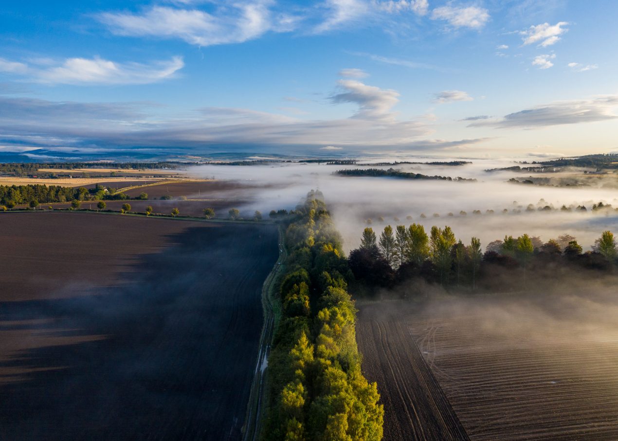
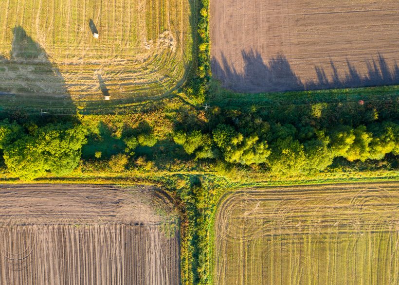
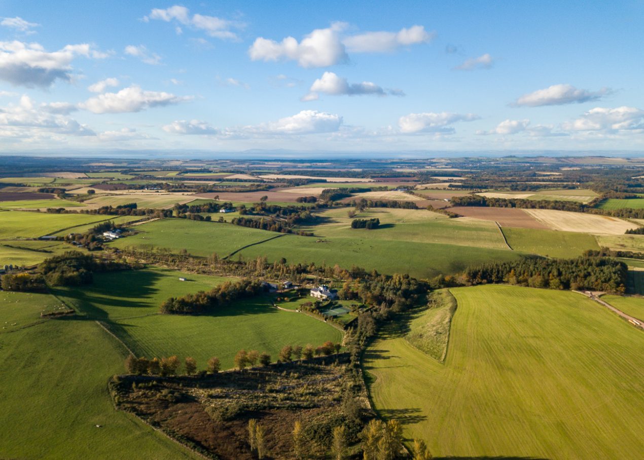
Green Corridor
Disused railway lines have become vital wildlife corridors, providing shelter, food, and safe passage for birds, mammals, and insects. But they also tell stories of past industry. Now a core path, the branch line that once connected Perth to Blairgowrie was a key artery of Perthshire’s textile trade. Built in the 19th century, it carried raw materials and finished goods between the mills and wider markets. Though the tracks are long gone, the old line now serves different passengers—wildlife making its own journeys through a landscape shaped by agriculture and industry.
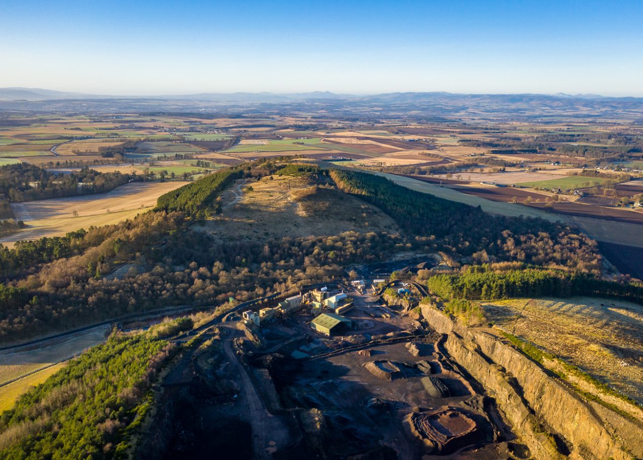
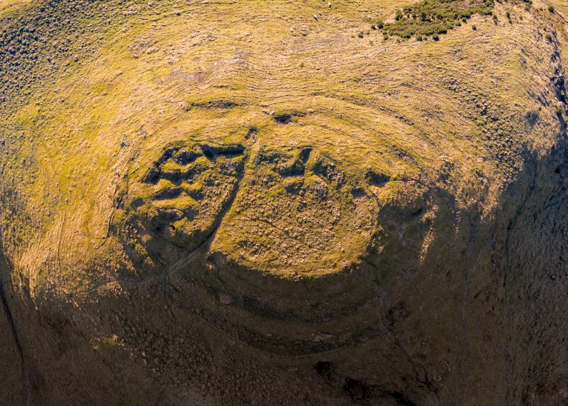
Macbeth’s Quarry
Dunsinane Hill is steeped in myth, forever linked to Macbeth’s fate and the legends that swirl around his downfall—when Birnam Wood was said to march upon these slopes. Today, the hillside itself is quarried, rock removed beneath the shadow of the ancient fort to pave the roads of a very different Scotland. Here, drama and industry meet: the echoes of Shakespeare’s tragedy linger above, while the ground below is reshaped by new demands in a landscape where generations, both ancient and modern, have left their mark.
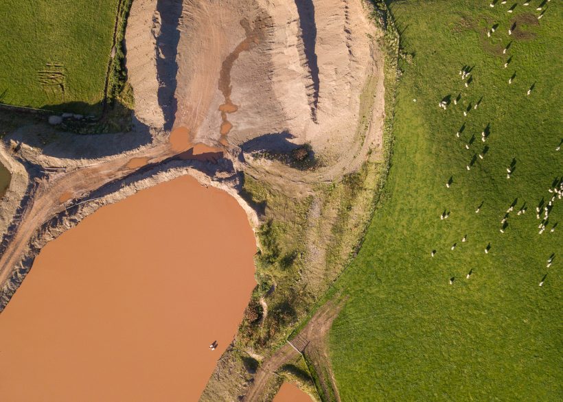
Rural Quarry
Amongst the farmland of East Lothian, a quarry breaks through the land, its raw excavation standing in stark contrast to the patchwork of surrounding fields. Both are forms of extraction—one drawing life from the land, the other taking stone from the ground. Yet, while we often see farmland as a harmonious and familiar part of the landscape, quarries appear abrupt and unsettling, their scars less easily absorbed into our sense of place. Eventually, quarries may be reclaimed by nature, over time filling with vegetation and wildlife. Until then, they remain open wounds on the landscape.
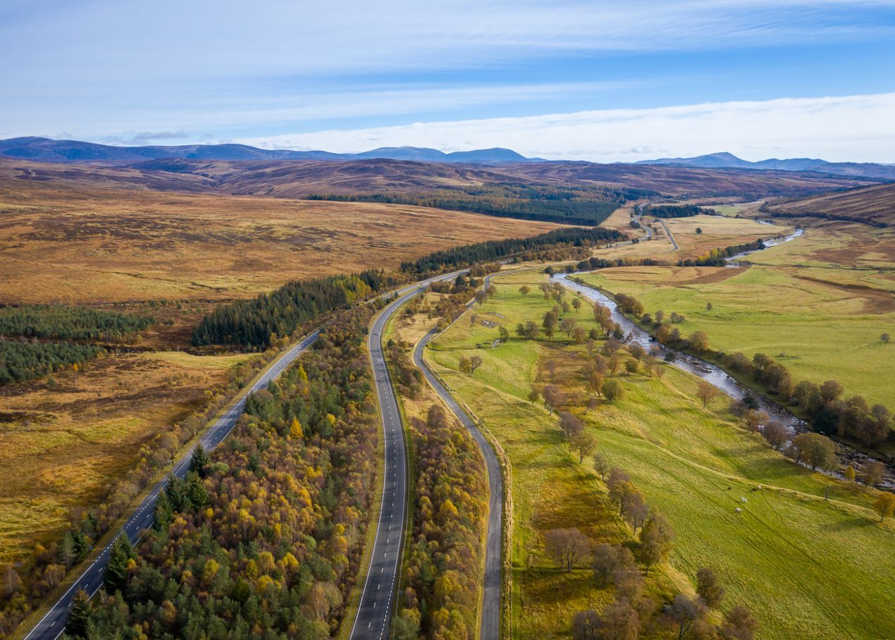
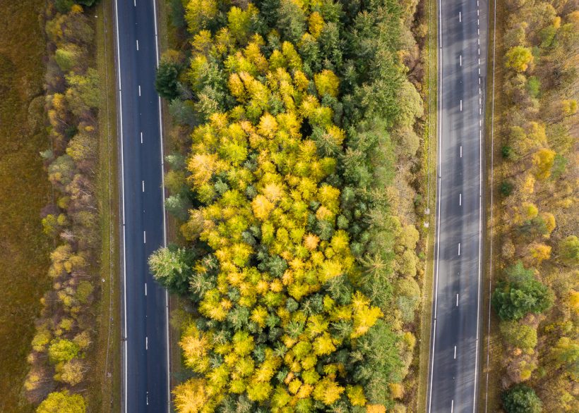
Central Reservation
The A9 cuts a line through the Highland landscape—a corridor of movement carved through moorland and pasture. On either side, grazed fields and open hills show the long reach of farming and the hand of estates managed for sport. But the narrow strip between the carriageways is protected from grazing, and over time trees have taken hold, revealing how quickly nature reasserts itself when grazing pressure is removed.
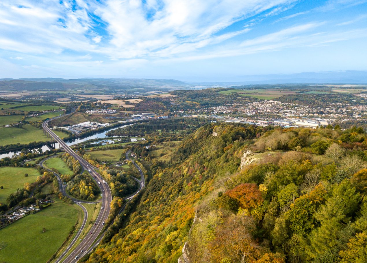
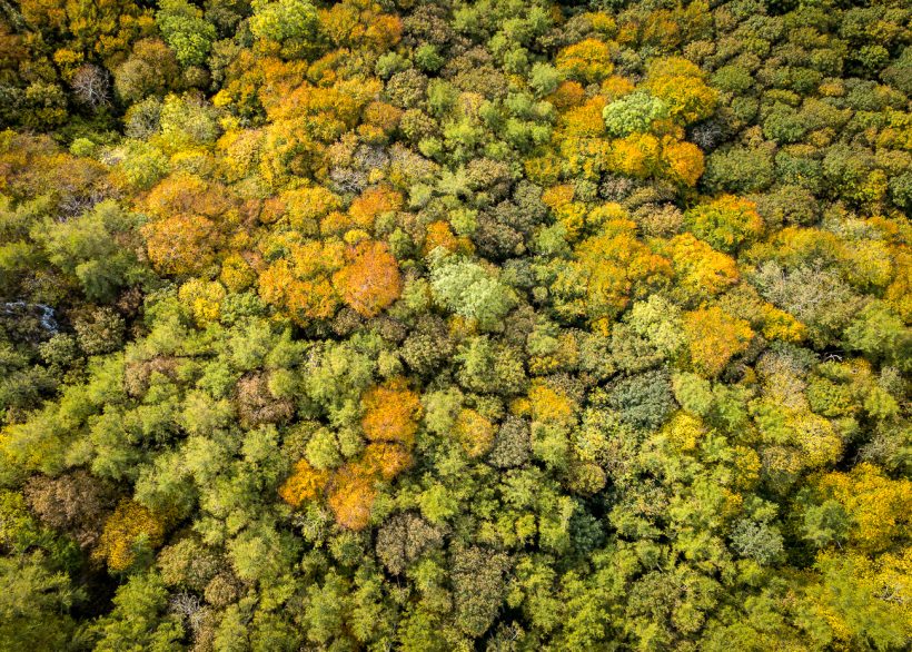
Interchange
The view over Perth from Kinnoull Hill reveals a landscape shaped by infrastructure, with roads winding through the countryside as the River Tay flows toward the sea. Just below the escarpment, steep ground shields a pocket of mature woodland. Oak, beech, and birch cling to the slope, and seen from above, gaps between the treetops reveal crown shyness—a subtle, natural spacing between trees that quietly echoes the scattered developments spread across the landscape beyond.
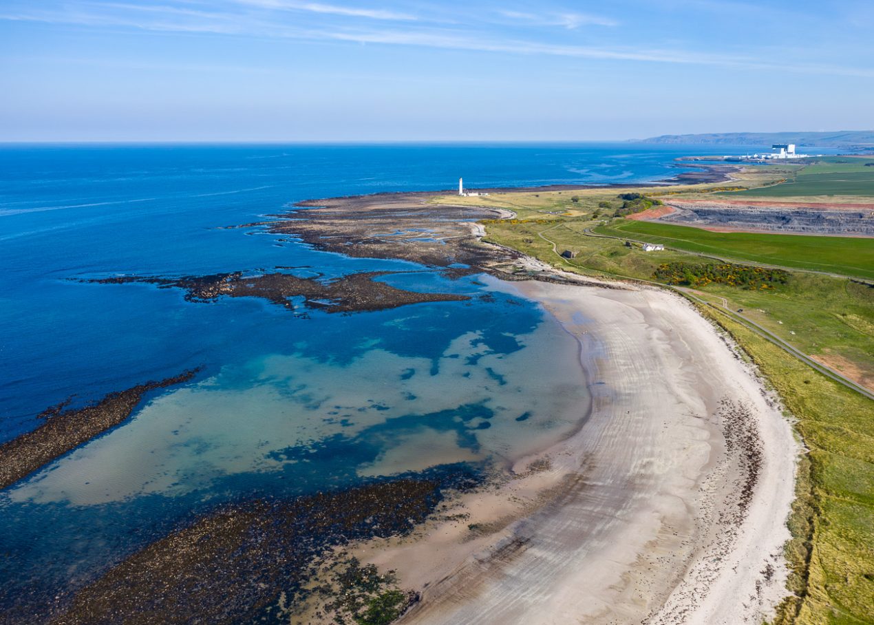
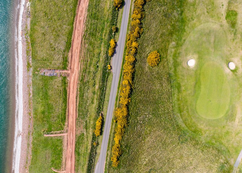
Nuclear Bunkers
A lighthouse, decommissioned but intact, sits at one end of a white sand beach, with a golf course at the other. The landscape here is manicured—bunkers and greens pressed close to the shoreline. In the distance, a nuclear power station stands: its presence both unmissable and yet largely unnoticed. Beneath it all, the ancient geology of Barns Ness speaks to a timescale far beyond human memory. While nuclear offers low-carbon energy for the present, its legacy—like the bedrock beneath—will endure for generations.
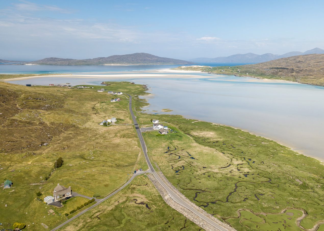
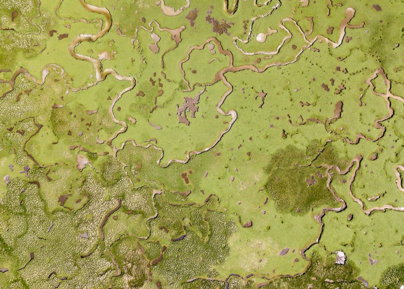
Machair
The machair near Luskentyre on the Isle of Harris showcases a rare coastal habitat where fertile grasslands meet expansive beaches. This unique ecosystem supports a rich mix of wildflowers, birds, and insects, thriving on a delicate balance between sand and soil. Historically, traditional low–intensity grazing and crofting practices maintained this balance. However, like many fragile ecosystems, it faces threats from climate change, rising sea levels, and changing land use practices. The intricate patterns visible from above hint at both the resilience and vulnerability of this ancient landscape, shaped by natural forces and human stewardship.
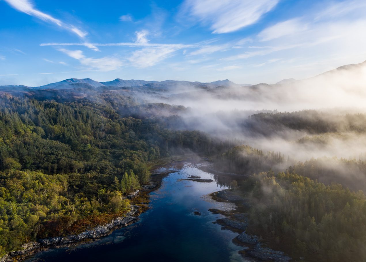

Viking Harbour
Sàilean nan Cuileag on Loch Sunart, translated from Gaelic as the Bay of Flies, has long served as a natural harbour. Once used to export goods such as charcoal, oak bark, and brushwood—and said to have sheltered Viking boats through the winter months—its shoreline has seen centuries of human activity. Yet over time, these traces have been eroded by wind and water. Seen from above, the tidal shallows reveal a natural mosaic of kelp and bedrock, with colours and textures not visible from the ground.
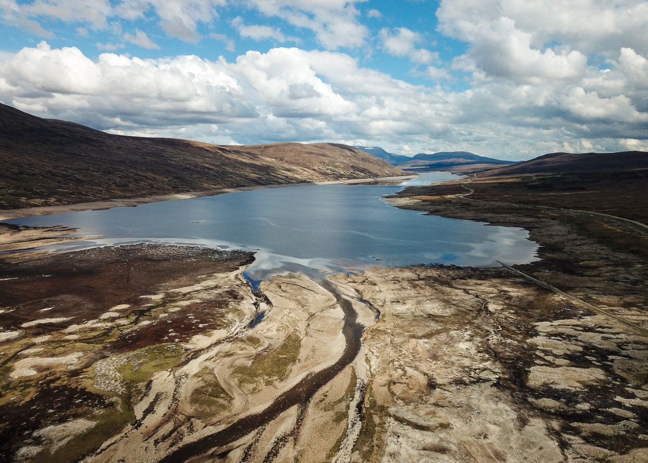
Dry Loch
During periods of low water, reservoirs reveal remnants of their pre-flooded landscape. Ancient tree stumps, abandoned roads, and even houses emerge, offering a rare glimpse into the glen as it was before being submerged for hydroelectric power in the 1950s. The cracked, exposed earth tells a story of human intervention and lost ecologies, revealing the shifting relationship between nature and infrastructure—where landscapes are reshaped, but the past is never quite washed away.
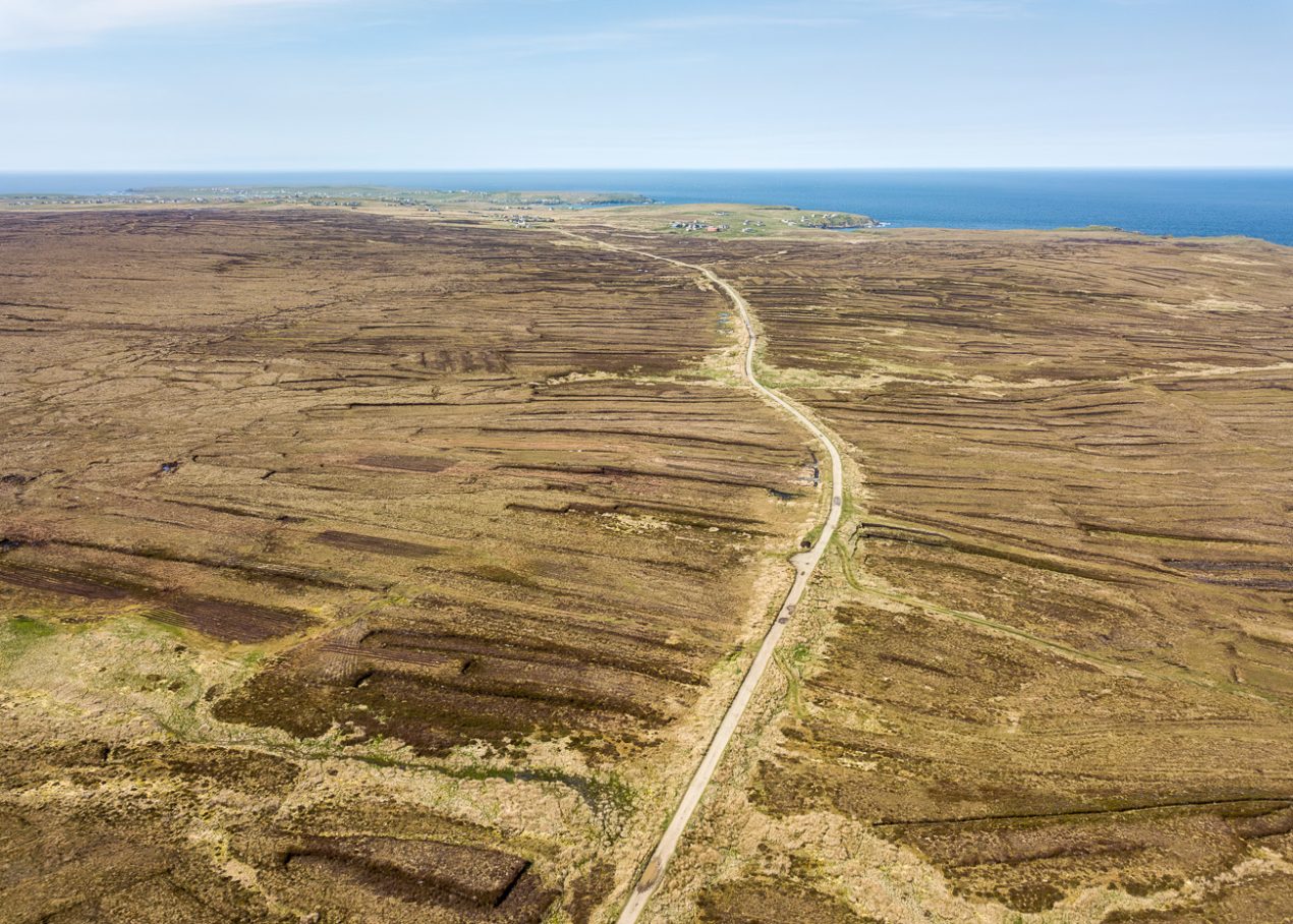
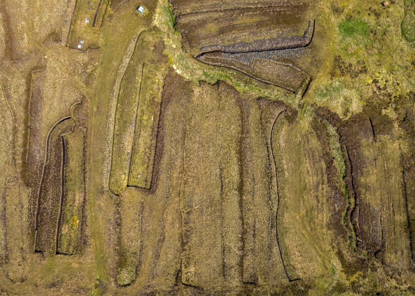
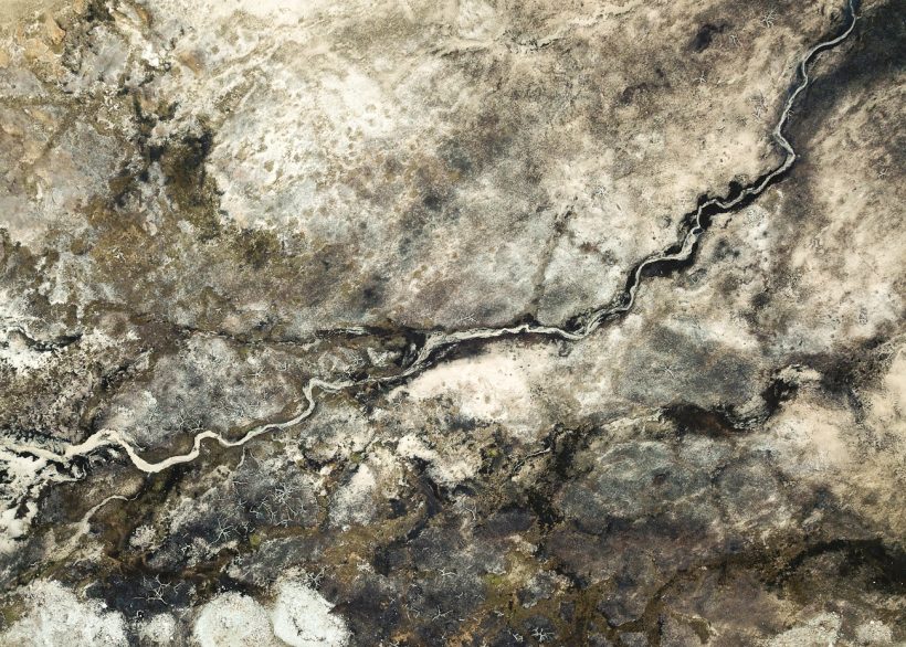
Peat Cuts
Across the Isle of Lewis, the land is scored with the dark lines of hand-cut peat—a practice that has provided fuel for generations. For many island communities, peat remains a culturally significant heat source. Yet beneath the surface lies a contradiction: more than 20% of Scotland is covered by peatlands—important carbon stores, locking away centuries of atmospheric carbon. Landscapes such as this bear the weight of both tradition and the growing urgency of climate change.